History
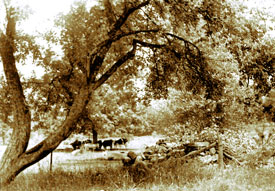
The Town of Deerpark is a rural town in the southwestern corner of Orange County. It is nestled among lakes, streams, rivers and mountains and is bounded by the Delaware, Neversink, and Mongaup Rivers, the Shawangunk Mountains, and the wetlands of the Basha Kill. Geography has been a major factor in the town’s growth and development.
This land was the frontier of early America. Covered wagons carrying pioneer stock trundled westward from the Hudson River to settle here. A settler named McDaniel enclosed a small tract of land with a fence made of brush. Some of his neighbors called it McDaniel’s “Deerpark”. Soon the entire area was known by that name.Seven hamlets, Cahoonzie, Cuddebackville, Godeffroy, Huguenot, Rio, Sparrowbush and Westbrookville make up the Town of Deerpark. The origins of these names reflect the history of the town.Cahoonzie is located on land where the Cahoonshee Indians lived and where Chief Cahoonzie is buried. Cuddebackville is named for William Cuddeback, a colonel in the War of 1812 and a descendant of one of the first families. Godeffroy is named for Adolphus E. Godeffroy, an active participant in the Port Jervis & Monticello Railroad. He
 built an extensive estate in the area which now bears his name.
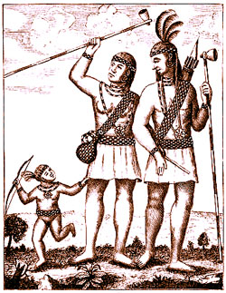
Huguenot originally was called “Sindeaquan” by the Lenni Lenape Indians. The earliest settlers called this area “Peenpack”. Later the hamlet was named in honor of the early Huguenot refugees who came here seeking religious freedom. The peaceful Lenni Lenape Indians were the first inhabitants. Chief Penhorn and his tribe inhabited about 780 acres of fine natural meadow land on the east side of the Neversink River. In 1690, William Tietsoort, the first European inhabitant in the valley, was asked to move here by the Lenni Lenape to build a blacksmith shop to make much needed tools.
Rio was known as “Quarry Hill”. Bluestone from local quarries was mined and shipped via the D & H Canal to New York City for its sidewalks. When the town requested a post office, they were notified that there was another town named Quarry Hill in New York. The citizens then decided to name their hamlet Rio in honor of Ben Ryal, a post master who had been instrumental in organizing the post office. Apparently, when his name was spoken, the letter “l” was dropped so that his name sounded like “Rio”.
Sparrowbush originated from Henry L. Sparrow, owner of a large tract of timberland near the D & H Canal. This land had been called Sparrow’s “Bosh”, meaning Sparrow’s slope or Sparrow’s “Bosk” meaning Sparrow’s thicket or woods. Over the years it changed to its present name, Sparrowbush.
Westbrookville was named for Dirck Van Keuren Westbrook, an early settler. Fort Westbrook, dating back to the American Revolution, still stands.
 In 1697, a 1200 acre patent of land was granted to Jacob Codebeck, Thomas Swartwout, Anthony Swartwout, Bernardus Swartwout, Jan Tyse, Peter Germar (Gumaer) and David Jamison. They were sturdy Dutch and Huguenot farming families and lived peacefully with the Lenni Lenape.
With the early rumblings of the French and Indian War, the local residents were asked to form a militia in preparation for the possibility of war. This broke the trust of the Lenni Lenape who subsequently moved west to the Ohio Territory.
Many families traveled along the Old Mine Road, America’s oldest 100 mile road, to settle in this fertile valley watered by pristine rivers. They were not, however, to live in peace. The boundary line between New York and New Jersey was still undetermined. Both states wanted the best farm lands along the disputed boundary line, which at that time cut across the entire town. Residents on both sides fought and kidnaped each other and destroyed each other’s homes and property during “The New Jersey-New York Border War”. Finally, on September 1, 1773, the present boundary line was established by England.
On October 13,1778, during the American War of Independence, Colonel Joseph Brant and his raiders approached by way of an old trail from the Mongaup River to Huguenot. The order of attack went from south to north ending at Fort DeWitt in Cuddebackville.
Brant returned again on July 20, 1779 bringing with him twenty-seven Tories and sixty Indians to fight against the settlers. It was this raid which lead to the major battle at Minisink Ford where many local militiamen lost their lives. It also was the source of “The Painted Apron Story” at the Black Rock School, a local folk tale, which has become a part of our history.
When the War of Independence ended, the pioneer spirit took hold again, and some residents left this valley to follow the westward dream. The abandoned land enabled those who remained to enlarge their holdings and build bigger farms and mills.
In 1798 the counties that we know today were created by the New York State Legislature. Deerpark was established from the Town of Mamakating (Ulster Co.) and the Town of Minisink (Orange Co.)
© 2024 ~ 1863schoolhouse.org | All Rights Reserved | Phone: 845 856 2702 | Fax: 845 856 0935